Had this high altitude balloon flight in my mind now for years since 2010 or so, but since Honolulu is a RED airportit should be very difficult to launch a balloon on the islands of Oahu. Even recovery would be almost impossible with the mountain ranges and the surrounding Ocean. I bought a lot of equipment and balloons but put the project on ice. I even sold the balloons I bought on Ebay. But moving to Florida made the dream coming alive again. My two best rocket friends we very excited to do this BUT we had to wait for the right winds not to make a water landing. Jason Cook is an excellent programmer and made an awesome app for rocketry and recently after lots of hours of programming and testing he made the Balloon app. which was a unique missing piece in our balloon flight. Indeed recording altitude and directions and tracking the whole balloon is a must not to loose it.
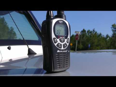
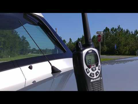
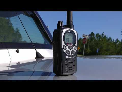
High altitude balloon attempt for later this year. Most of the parts are ready to go, just waiting on a few camera's for interval still images, Eric might have his video camera ready, Jason will provide the GPS and tracking, and I will get my WHISTLE dog tracker in the payload box.
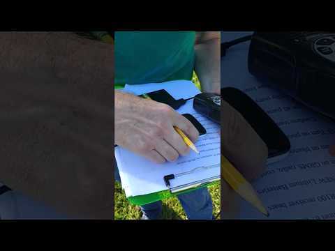
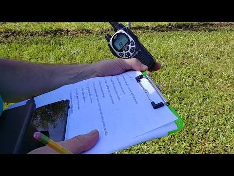
Parts list and checklist is all ready, just some fine tuning.
Update 06/13/2017 - Conversation with Jason, the balloon might take off soon, very soon, investigating all possibilities for launching now, even Shawns place in Hihara will work great, Shawn is ok with that and will help out. So far we will contact the FAA and the airports in Ga.
Update 06/15/2017 - Both camera's are working great, The 7 Mpxl camera recorded for 2.30 hrs before the battery died, st at 30 sec captures. The 12 Mpxl camera recorded beyond 3 hrs, stopped he process prematurely but has enough battery life left probably for 4 hrs.
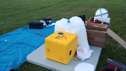
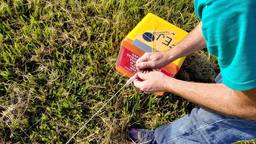
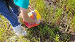
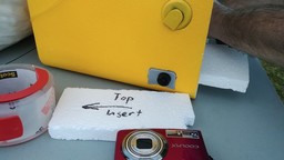
Making a bunch of calculations now, we HAVE to keep the positive lift at around 300 grams to get the best results in time and altitude !!!! Just updated the payload to 1000 grams = 2 Lbs (Box / 1 camera / Jasons' phone / tracking / deflector / Erics camera / parachute.)
Update 06/18/2017 - Right now the calculations are: Ascent time 151 minutes, decent time 40 minutes.
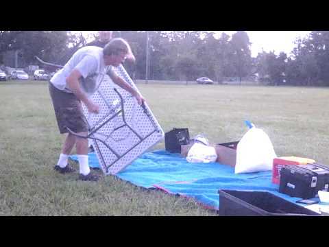
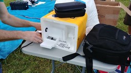
Update 06/18/2017 - Did some work on the payload box. Build a compartment for my Nikon camera as well around Eric his video camera. Used Loctite for the foam, works great and fast. Also cut the filler in a straight position, is much better to calculate the positive lift. The weight of the short filler is now 220 grams.
Looks like we are GO for Launch on July 1st, 2017, just need to find a nice spot with no air-traffic control issues... 8 AM in Banford, Florida..
Update 06/26/2017 - This week I will go over the XL list every day and also get the weather forecasts for Sanderson AND Macclenny. We really can not have that the balloon enters Jacksonville or Cecil airspace..
Update 06/27/2017 - Tim his PR100 tracker just came in, BUT the weather forecast for the weekend does not look great for all over Florida AND Georgia also. So we might skip the launch this time and move to another weekend.
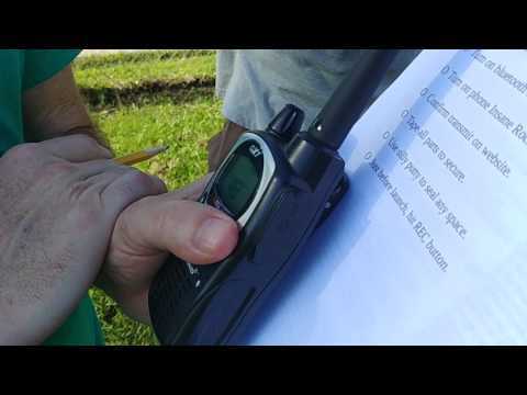
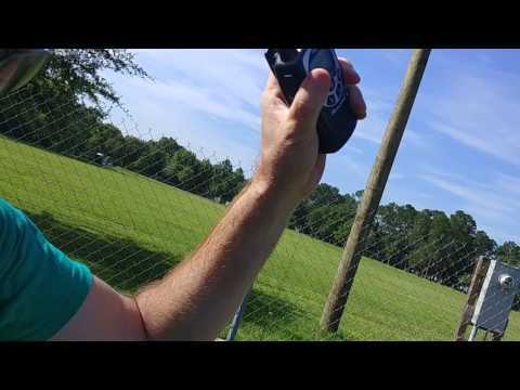
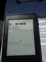
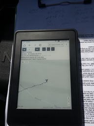
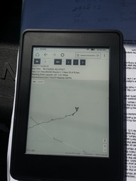
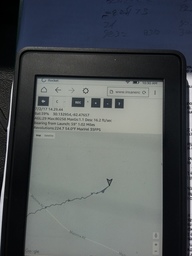
NOTE: For this launch occasion Jason Cook wrote an extraordinary App code for the balloon for telemetry , tracking/GPS and video recording in steps and altitude. Days of after work and night went into his work. I really appreciate what he did to make this balloon flight happen any time soon, but weather is not cooperating for now.
Update 06/30/2017 - Weather seems to look better for Sunday morning launch around 08:00 AM, New calculations turning out better west landing in Sanderson dry area. Notam filed by Jason, checked by Eric and Freddy. All seems to look great but Ya it's a Sunday... Hope fast recovery, have lots of real work to do also. Hoping on great video and pictures from this first flight.
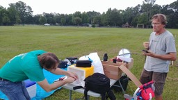
Update 07/01/2017 - Home after work, loading everything in the car for tomorrow.... Double checking weather reports and trajectory.. Our lift off weight will be around 1320 grams that includes: Jason's equipment (foam box and radio and phone and swivel) - Eric his camera and extra battery - Freddy's crap Camera/ whistle/ deflector/ parachute. Weight might add up with duct tape and foam chips.. So I'm calculating 1400 grams for load and 500 grams positive lift... tada
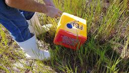
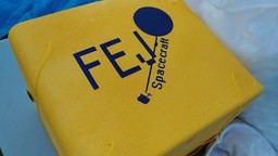
NAME OF THIS FLIGHT is: FEJ one
For this flight the 12 meg pxl camera will be used on my side, Eric will use his small video camera and Jason his 4K nexus phone..
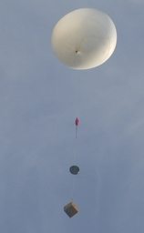
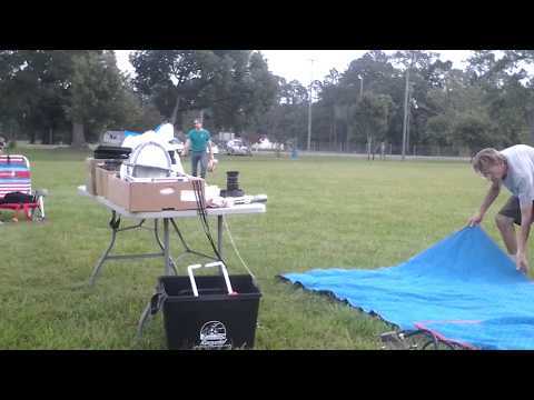
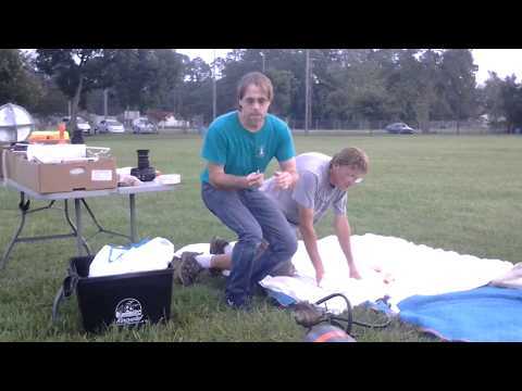
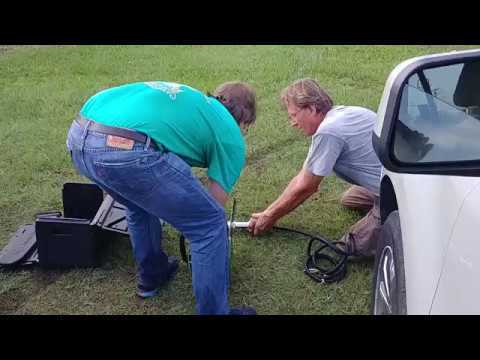
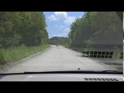
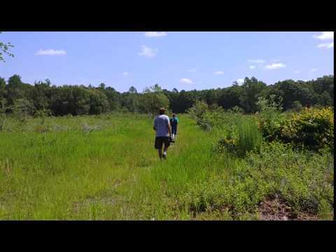
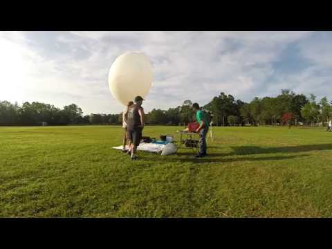
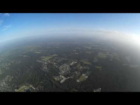
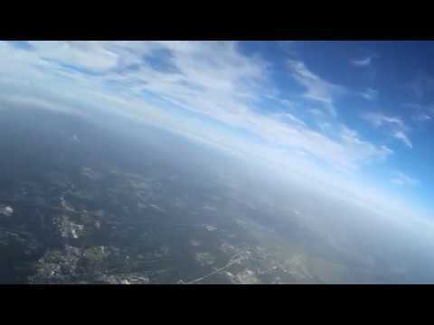
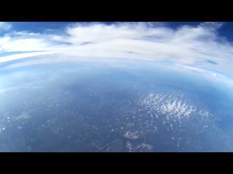
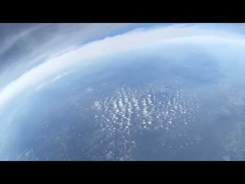
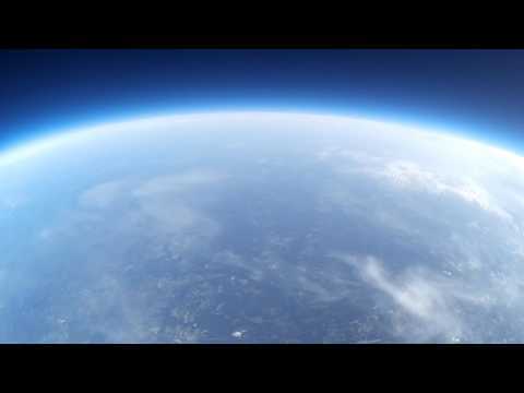
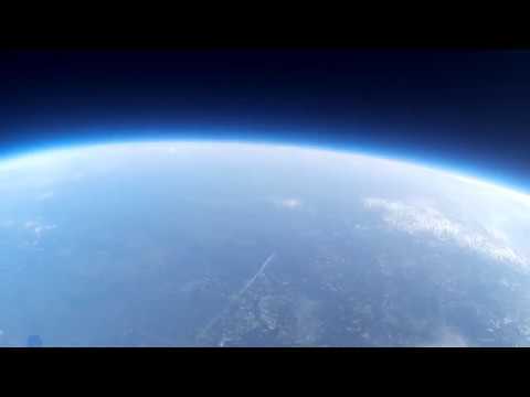
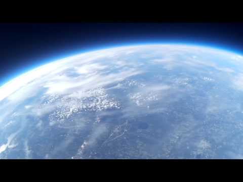
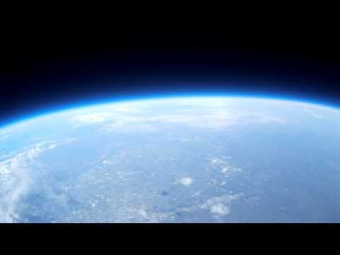
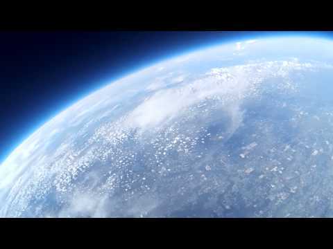
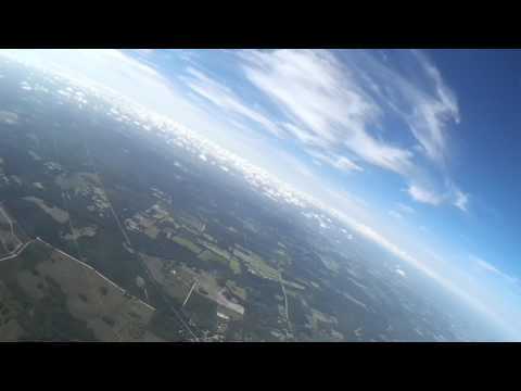
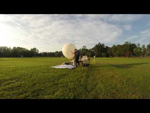
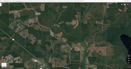
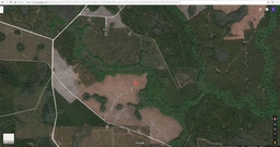
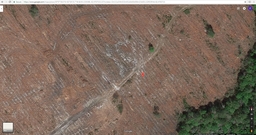
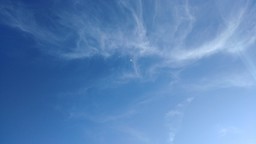
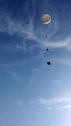
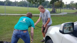
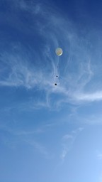
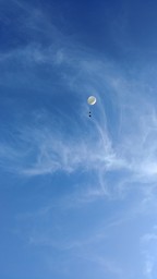
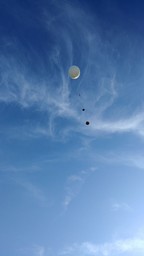
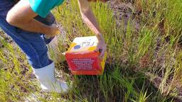
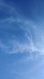
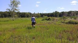
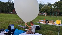
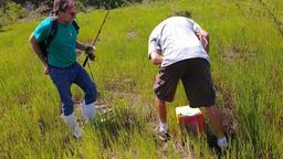
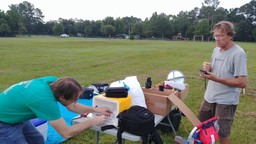
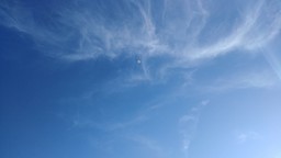
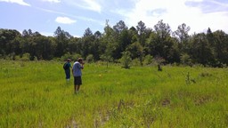
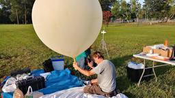
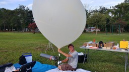
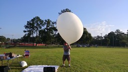
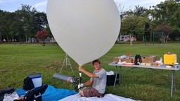
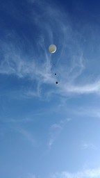
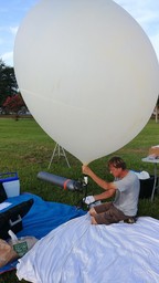
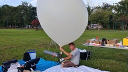
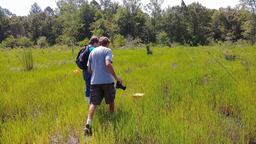
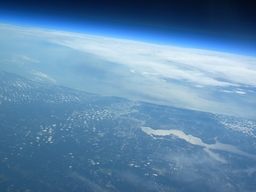
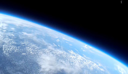
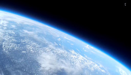
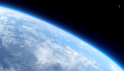
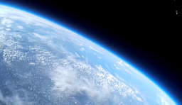
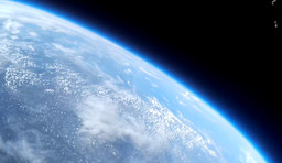
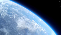
Update 07/02/2017 - YES ! Beautiful day, early morning start like 6 AM prepping and 8.05 Launch that balloon. We did great, some issues with the box and the filling. Had to cut the filler pipe to get the neck of the balloon around it. Filling was a breeze like 10 - 15 Minutes !!! Got all the stuff connected and launch the balloon !!! We had like 600 grams positive lift the total pull was around 2000 grams !!! The actual weight of the chute/deflector and box was around 1190... All components worked well, Hats of for Jason to make the tracking a breeze... We could follow it all the way up and also with the binoculars !! Eric has Eagle eyes !! He could see it naked !!! At 77.000 feet we left the park and headed to the impact zone. The balloon popped while we were driving and we stopped on the exit of Sanderson to get the coordinates right to drive to the impact zone.. It took us all the way out west and also into a 6 + mile dirt road. We had to walk to the low bush and some swamp situations to get to the balloon, like a 0.7 mile walk. Glad it landed in an open field !!!
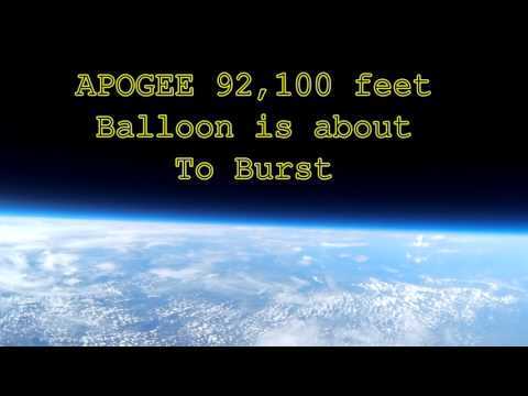
Confirmedby Jason: Apogee = 98100 feet !! = 14.145 hPa
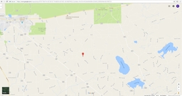
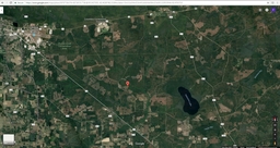
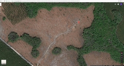
Impact coordinated: 30.1329539 - W82.4765715(-)
Impact side was very close to the predicted one. The total flight time was 8.841 sec = 2 hours and 21 minutes and 21 seconds.
Apogee 98100 feet was reached on 6690.7 seconds = 1 hour and 51 minutes and 30 seconds.
Google Earth File:50fee3115a4c445a.kml


 1 ... 10 11 12 13 14
Comments
Lets do this!!!
Where will you launch it?
My house or Jason his house, depending on the winds Tim....Have a calculator that gives the trajectory but works only like 12 hrs before the event and is pretty accurate..
timcub on 2016-08-16 13:45:46Z wrote:
Good luck!
Thanks Tim..
timcub on 2017-06-27 11:48:41Z wrote: